
Scoping Study

What is a scoping study?
A scoping study develops and evaluates multiple design alternatives, then selects a preferred alternative for implementation. This process involves developing distinct options from minimal to full construction, evaluating alternatives based on cost, safety, and community input, assessing environmental constraints and property impacts, engaging the public in alternative selection, and choosing the option that best meets project goals.

STUDY TEAM
Misha Golfman, MRP, team leader
Mac Rood, MRP Board Chair
Jennifer Conley, Director of Transportation Systems, VHB, Consultant
Joshua Schwartz, MRVPD Executive Director
Reuben McMartin, CVRPC, Senior Transportation Planner, MPM
Scott Robertson, VTrans Coordinator
study timeline
| Task | Timeline |
|---|---|
| Project Kick-off Meeting | September 2024 |
| Compile Base Mapping / Document Existing Conditions | September – November 2024 |
| Identify Resource Constraints & Permitting Requirements | October – December 2024 |
| Public Meeting #1 – Local Concerns Meeting | November 2024 |
| Develop Conceptual Alternatives | December 2024 – March 2025 |
| Public Meeting #2 – Alternatives Presentation | March 2025 |
| Draft Scoping Study Production | March to May 2025 |
| VTrans Review (minimum 3 weeks plus 2 weeks for comment resolution) | May to June 2025 |
| Public Meeting #3 – Presentation of Draft Ranked Alternatives | June 2025 |
| Final Scoping Study Production & Submission | July 2025 |
| Final Public Meeting and Scoping Study Presentation | October 2025 |
major findings
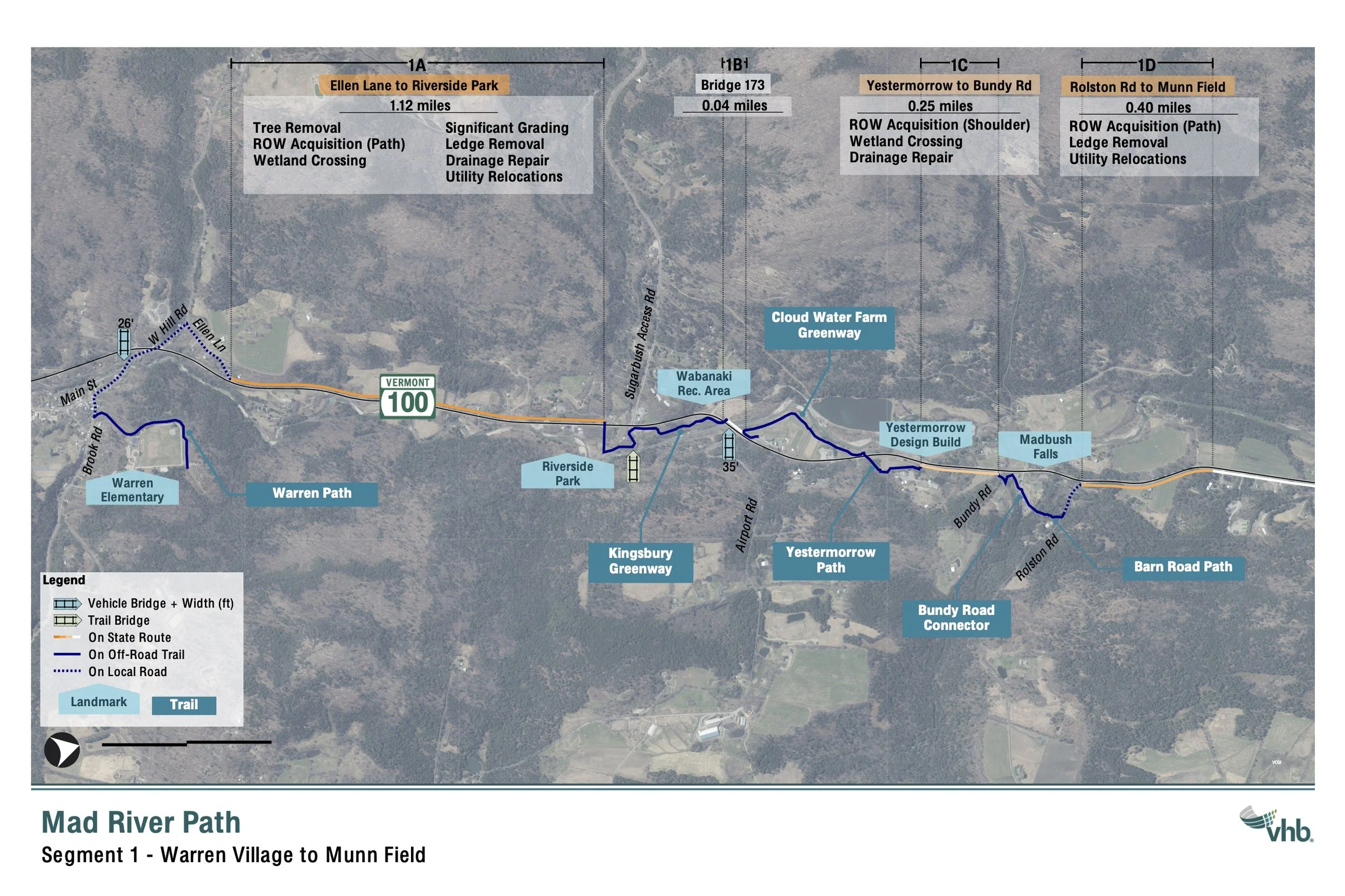
Three alternatives were evaluated: Alternative A would improve existing trails only, Alternative B would add widened bike lanes along Route 100/100B, and Alternative C would build a 10-foot separated path from traffic.
The study demonstrated strong community support for Alternative C with over 200 residents participating across two public meetings resulting in 218 out of 280 votes (78%) supporting a fully separated shared-use path.
The study identified the preferred alternative to be a hybrid approach that prioritizes safety by combining new construction of a 10-foot wide, shared-use path, with improved existing trails where feasible. This approach would provide safe active transportation access for all ages and abilities, linking villages to schools, businesses, and recreation areas, serving as a major tourism and economic development driver, and creating Vermont’s premier multimodal corridor.
Implementation will begin with a 1.1 mile section from Warren Village to Riverside Park.
phasing
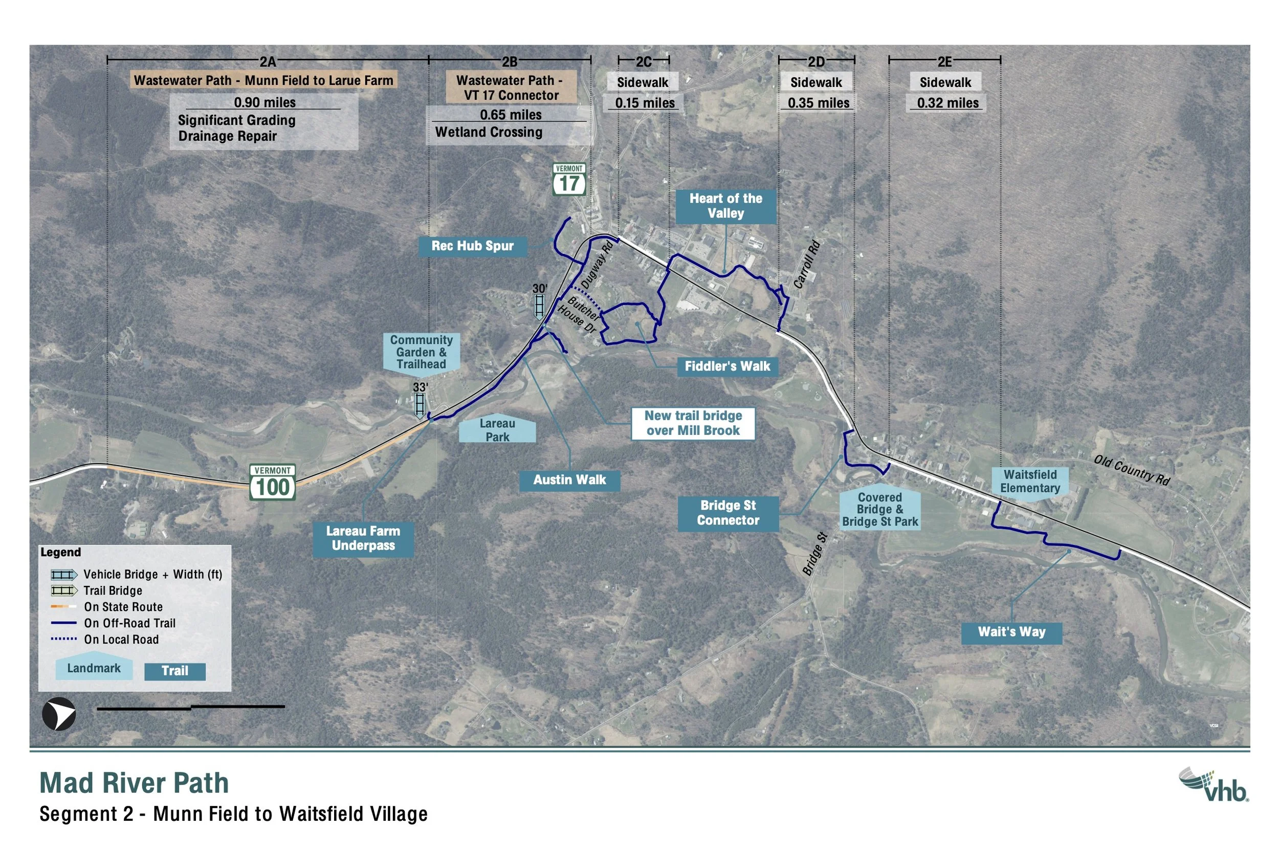
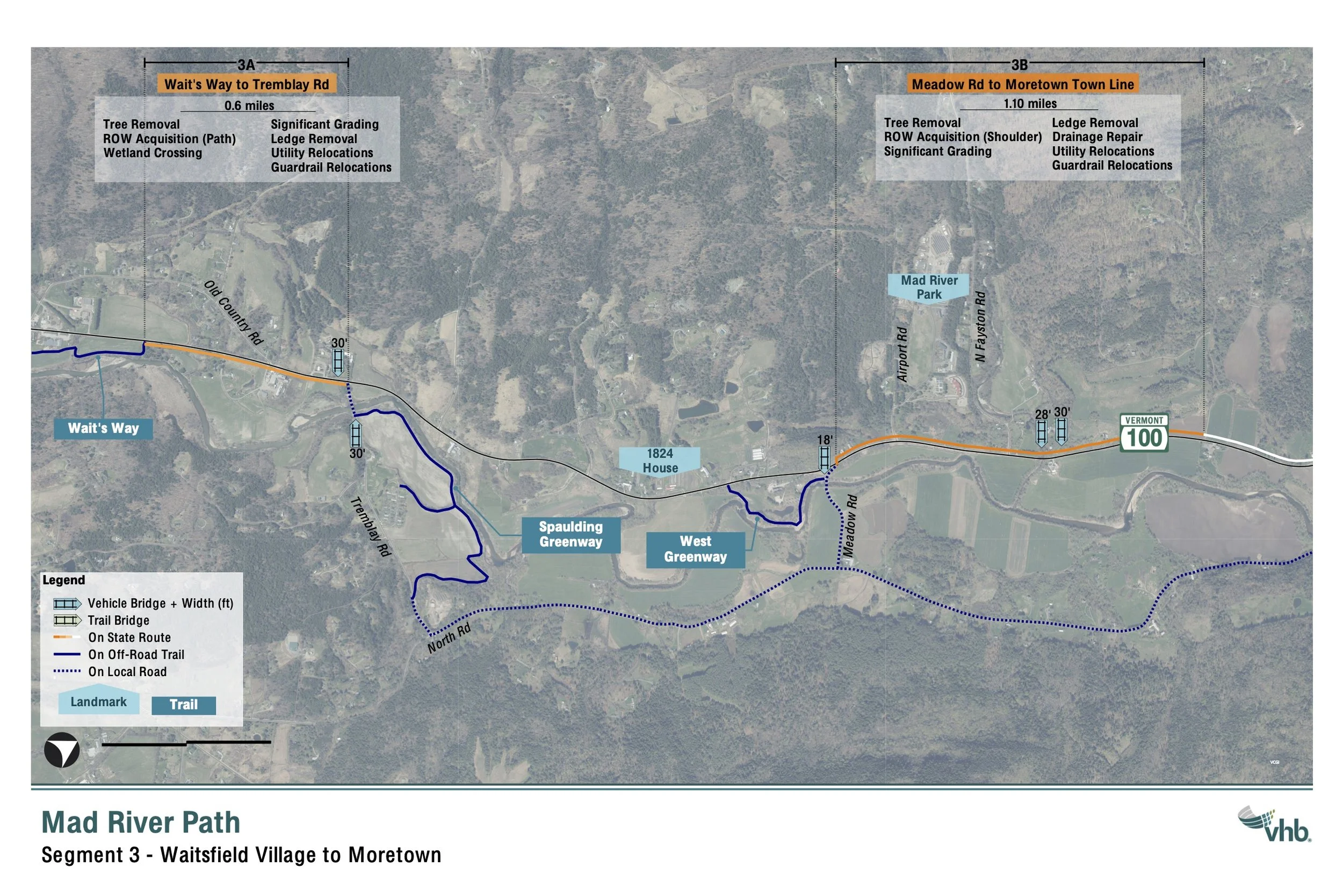
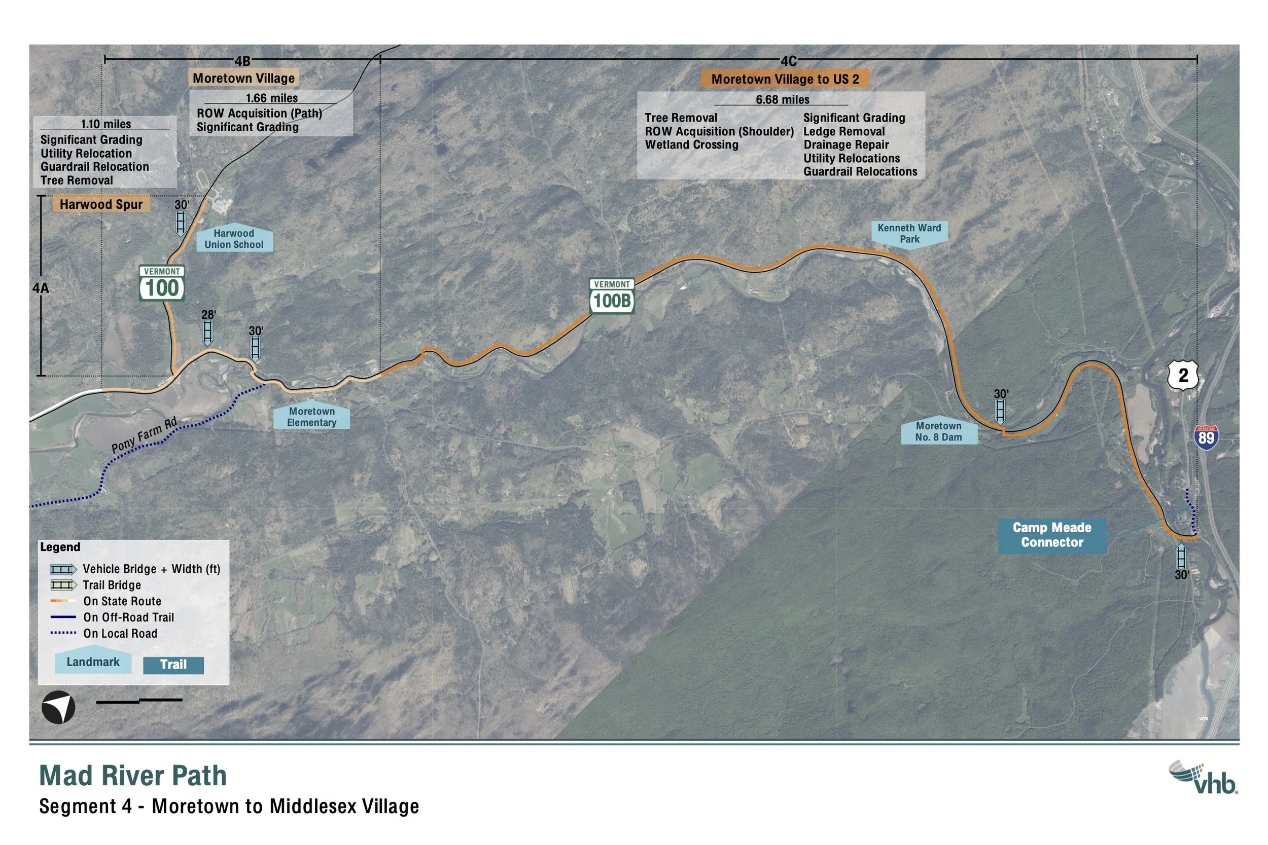
Phasing prioritizes segments that close the gaps between the existing sections of the Mad River Path. These are the “low-hanging fruit” opportunities, where the construction of a relatively short segment of the off-road path creates several miles of connectivity.
Phase I-II implementation – 2026-2030
Numbers correspond to the 1-10 on the map above.

*The VT 100 bridges at Wabanaki Recreation Area and Lareau Farm will be crossed via interim configurations (such as bollards separating bike/foot and vehicle traffic). ** Does not onclude Warren Village - Ellen Lane striping and Yestermorrow to Munn Field Segment
PHASES III - V (WAITSFIELD - MIDDLESEX) IMPLEMENTATION TIME ESTIMATE: 2026 - 2035
Stay tuned for more updates as we move through phases of implementation.